![](/images/other/stat-length.png)
![Tocht Stappen Le Morne-Vert - Montjoly - Les pitons du Carbet - Photo](https://media.geolcdn.com/t/1900/400/2c304681-e19e-4adf-bba6-bc5f382e62ec.jpg&format=pjpeg&maxdim=2)
Montjoly - Les pitons du Carbet
Ba Sa Balan
Gebruiker
![Lengte](/images/other/stat-length.png)
Lengte
5,2 km
![Max. hoogte](https://static1.geolcdn.com/siteimages/upload/files/1508320355ic_sort_altitude_max_24dp.png)
Max. hoogte
1193 m
![Positief hoogteverschil](https://static1.geolcdn.com/siteimages/upload/files/1508320355ic_sort_den_pos_24dp.png)
Positief hoogteverschil
852 m
![Km-Effort](/images/other/stat-length.png)
Km-Effort
16,2 km
![Min. hoogte](https://static1.geolcdn.com/siteimages/upload/files/1508320355ic_sort_altitude_min_24dp.png)
Min. hoogte
460 m
![Negatief hoogteverschil](https://static1.geolcdn.com/siteimages/upload/files/1508320355ic_sort_den_neg_24dp.png)
Negatief hoogteverschil
747 m
![Boucle](https://static1.geolcdn.com/siteimages/upload/files/16400158638029165_repeat_loop_refresh_sync_direction_icon.png)
Boucle
Neen
Datum van aanmaak :
2021-03-11 13:32:18.294
Laatste wijziging :
2021-03-12 11:02:52.393
![Stappen](https://static1.geolcdn.com/sitytour/trail-icons/101.png)
6h26
Moeilijkheid : Zeer moeilijk
![Scan deze QR-code om de tocht te openen in de SityTrail-applicatie](https://capi.geolives.com/qq0zvz2zws4bq2lad0pu/sitytour/trails/2704440/qr.png?size=200)
Gratisgps-wandelapplicatie
Over ons
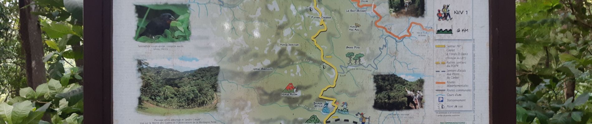
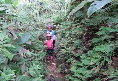
Tocht Stappen van 5,2 km beschikbaar op Martinique, Onbekend, Le Morne-Vert. Deze tocht wordt voorgesteld door Ba Sa Balan.
Beschrijving
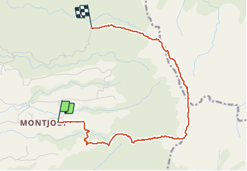
départ place Nelson Mandela à Montjoly.
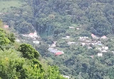
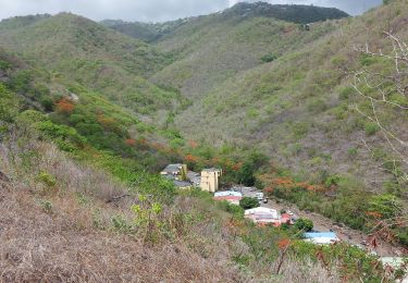
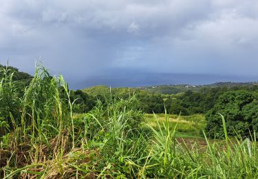
Morne Tranchette, Piton Lacroix, Morne Piquet, Morne Modeste.
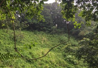
Très escarpé, jamais sans guide car traces non faites
Plaatsbepaling
Land:
France
Regio :
Martinique
Departement/Provincie :
Onbekend
Gemeente :
Le Morne-Vert
Locatie:
Unknown
Vertrek:(Dec)
Vertrek:(UTM)
701388 ; 1625997 (20P) N.
Opmerkingen
Wandeltochten in de omgeving
![Tocht sport Fort-de-France - Absalon vers Didier - Photo](https://media.geolcdn.com/t/375/260/adf8a0b9-d2e0-4a1f-aaf4-a96938158482.jpg&format=jpg&maxdim=2)
Absalon vers Didier
sport
Heel gemakkelijk
(1)
Fort-de-France,
Martinique,
Onbekend,
France
![](/images/other/stat-length.png)
6,3 km | 8,9 km-effort
Onbekend
![](https://static1.geolcdn.com/siteimages/upload/files/16400158638029165_repeat_loop_refresh_sync_direction_icon.png)
Neen
![Tocht Stappen Fort-de-France - fond barron - Photo](https://media.geolcdn.com/t/375/260/e47fa9db-42eb-4eae-be0a-ef7b2c9eca79.jpg&format=jpg&maxdim=2)
![Stappen Stappen](https://static1.geolcdn.com/sitytour/trail-icons/101.png)
fond barron
Stappen
Moeilijk
(1)
Fort-de-France,
Martinique,
Onbekend,
France
![](/images/other/stat-length.png)
6,4 km | 10 km-effort
2h 50min
![](https://static1.geolcdn.com/siteimages/upload/files/16400158638029165_repeat_loop_refresh_sync_direction_icon.png)
Ja
![Tocht Stappen Fonds-Saint-Denis - Fonds saint Denis (Martinique) - Photo](https://media.geolcdn.com/t/375/260/ext.jpg?maxdim=2&url=https%3A%2F%2Fservices.sitytrail.com%2FGeolivesWS%2FDownloadMedia.ashx%3FTrailID%3D897741%26Media%3D20180130144253.jpg)
![Stappen Stappen](https://static1.geolcdn.com/sitytour/trail-icons/101.png)
Fonds saint Denis (Martinique)
Stappen
Gemakkelijk
(1)
Fonds-Saint-Denis,
Martinique,
Onbekend,
France
![](/images/other/stat-length.png)
8,2 km | 13,7 km-effort
3h 28min
![](https://static1.geolcdn.com/siteimages/upload/files/16400158638029165_repeat_loop_refresh_sync_direction_icon.png)
Ja
![Tocht Stappen Fonds-Saint-Denis - Fonds st Denis - Photo](https://media.geolcdn.com/t/375/260/36793758-779d-4b0a-9402-46d88c044d08.jpg&format=jpg&maxdim=2)
![Stappen Stappen](https://static1.geolcdn.com/sitytour/trail-icons/101.png)
Fonds st Denis
Stappen
Moeilijk
Fonds-Saint-Denis,
Martinique,
Onbekend,
France
![](/images/other/stat-length.png)
10 km | 15,2 km-effort
3h 11min
![](https://static1.geolcdn.com/siteimages/upload/files/16400158638029165_repeat_loop_refresh_sync_direction_icon.png)
Ja
![Tocht Stappen Bellefontaine - Morne Potain - Mairie Bellefontaine - Photo](https://media.geolcdn.com/t/375/260/b0a5da16-b887-41c5-86a1-cbbf3074271f.jpg&format=jpg&maxdim=2)
![Stappen Stappen](https://static1.geolcdn.com/sitytour/trail-icons/101.png)
Morne Potain - Mairie Bellefontaine
Stappen
Gemakkelijk
Bellefontaine,
Martinique,
Onbekend,
France
![](/images/other/stat-length.png)
4,3 km | 5,7 km-effort
6h 0min
![](https://static1.geolcdn.com/siteimages/upload/files/16400158638029165_repeat_loop_refresh_sync_direction_icon.png)
Neen
![Tocht Stappen Le Morne-Rouge - Trace des Jésuites - Photo](https://media.geolcdn.com/t/375/260/20a7cdb5-63b7-4fc2-90a5-e7ffe952a822.jpg&format=jpg&maxdim=2)
![Stappen Stappen](https://static1.geolcdn.com/sitytour/trail-icons/101.png)
Trace des Jésuites
Stappen
Medium
Le Morne-Rouge,
Martinique,
Onbekend,
France
![](/images/other/stat-length.png)
5,2 km | 8,8 km-effort
2h 5min
![](https://static1.geolcdn.com/siteimages/upload/files/16400158638029165_repeat_loop_refresh_sync_direction_icon.png)
Ja
![Tocht Stappen Fort-de-France - Absalon - Photo](https://media.geolcdn.com/t/375/260/878d5ce9-c2d9-41df-828d-f3fa710d1ba4.jpg&format=jpg&maxdim=2)
![Stappen Stappen](https://static1.geolcdn.com/sitytour/trail-icons/101.png)
Absalon
Stappen
Moeilijk
Fort-de-France,
Martinique,
Onbekend,
France
![](/images/other/stat-length.png)
4,1 km | 7,9 km-effort
2h 25min
![](https://static1.geolcdn.com/siteimages/upload/files/16400158638029165_repeat_loop_refresh_sync_direction_icon.png)
Ja
![Tocht Stappen Le Morne-Vert - Trace Ti Jadin - Photo](https://media.geolcdn.com/t/375/260/3605b413-cbf4-425a-83cb-a870f6ded4a5.jpg&format=jpg&maxdim=2)
![Stappen Stappen](https://static1.geolcdn.com/sitytour/trail-icons/101.png)
Trace Ti Jadin
Stappen
Heel gemakkelijk
Le Morne-Vert,
Martinique,
Onbekend,
France
![](/images/other/stat-length.png)
3,3 km | 5,2 km-effort
2h 11min
![](https://static1.geolcdn.com/siteimages/upload/files/16400158638029165_repeat_loop_refresh_sync_direction_icon.png)
Ja
![Tocht Stappen Bellefontaine - POTAIN BARTHÉLÉMY - MAIRIE BELLEFONTAINE - Photo](https://media.geolcdn.com/t/375/260/d415b564-5e95-45b3-8ff5-997c4d071cbe.jpg&format=jpg&maxdim=2)
![Stappen Stappen](https://static1.geolcdn.com/sitytour/trail-icons/101.png)
POTAIN BARTHÉLÉMY - MAIRIE BELLEFONTAINE
Stappen
Medium
Bellefontaine,
Martinique,
Onbekend,
France
![](/images/other/stat-length.png)
3,5 km | 7,4 km-effort
2h 30min
![](https://static1.geolcdn.com/siteimages/upload/files/16400158638029165_repeat_loop_refresh_sync_direction_icon.png)
Neen